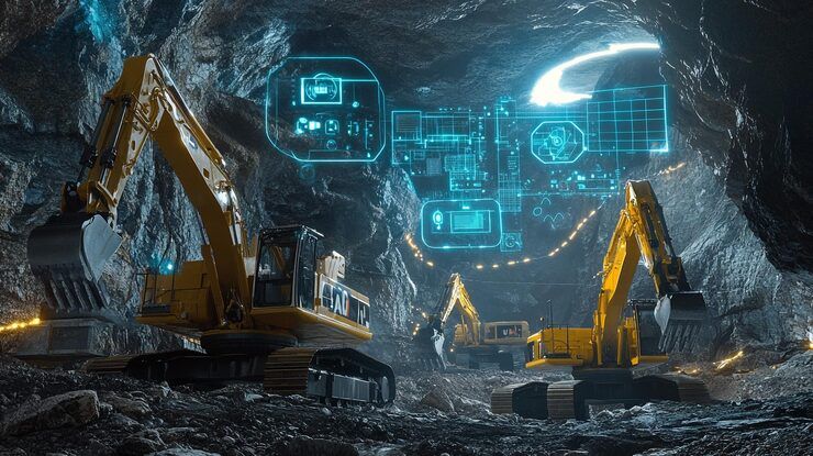
Mining site digital mapping uses geographic information systems (GIS), satellite imagery, surveying equipment, drones, and three-dimensional modeling to represent the physical characteristics of a mining area. These digital representations help mining teams understand terrain, identify geological features, measure changes, and organize spatial information for planning and monitoring.
Traditional mine surveying often relies on ground measurements, field observations, and engineering drawings. Digital mapping brings these information sources together in a geographic environment, making it easier to compare locations, analyze elevation, and maintain updated records.
Mining site digital mapping can be used during mineral exploration, mine development, active operations, environmental monitoring, and site rehabilitation. The methods selected depend on the size of the site, terrain, required accuracy, available technology, and applicable regulations.
Understanding Mining Digital Mapping
A digital mine map represents the physical and operational characteristics of a mining area. It may include elevation models, geological boundaries, roads, excavation zones, waste rock areas, water bodies, drainage channels, and infrastructure.
Different technologies capture different types of information.
Geographic Information Systems (GIS): Organize and analyze location-based information.
Drone surveying: Captures aerial photographs and overlapping images for mapping.
Satellite remote sensing: Provides large-area imagery and information about land-cover changes.
LiDAR surveying: Uses laser measurements to create detailed representations of terrain and structures.
Global Navigation Satellite Systems (GNSS): Support accurate positioning and field surveying.
Photogrammetry: Uses overlapping photographs to produce maps, point clouds, and three-dimensional models.
Digital elevation models: Represent ground elevation for terrain analysis and drainage assessment.
These technologies are often combined. For example, drone imagery can generate a surface model, GNSS measurements can establish survey control, and GIS software can integrate the results with geological and environmental information.
How Digital Mine Mapping Works
A typical digital mapping project begins by defining the area and deciding what information must be collected.
Survey teams then gather data using appropriate ground-based or remote sensing techniques. The collected information is processed into maps, elevation models, orthophotos, or three-dimensional representations.
The resulting data is checked for accuracy and integrated into a GIS or mine-planning environment.
Common project stages include:
Planning: Define boundaries, survey objectives, accuracy requirements, and data formats.
Data collection: Capture measurements using GNSS, drones, LiDAR, satellite imagery, or ground surveys.
Data processing: Convert measurements into usable geospatial datasets.
Quality control: Check coordinate systems, survey accuracy, coverage, and data consistency.
Spatial analysis: Examine elevation, excavation volumes, drainage, land use, and infrastructure.
Reporting: Produce maps, digital models, measurements, and records for operational decisions.
The final output may be a two-dimensional map, an interactive GIS project, a three-dimensional terrain model, or a time series showing how a site changes.
Why Mining Site Digital Mapping Matters
Digital mapping supports decisions that depend on accurate information about the location, shape, and condition of mining land.
Mine Planning and Surveying
Mining operations need reliable measurements of excavation boundaries, haul roads, stockpiles, benches, and other site features.
Digital terrain models can support volume calculations and comparisons between planned and actual excavation. Repeated surveys also help teams identify changes that may require engineering review.
The accuracy of these calculations depends on survey quality, the chosen reference surface, and consistent measurement methods.
Geological Exploration
Geologists combine topographic maps with geological observations, borehole records, geochemical measurements, and geophysical information.
GIS tools help display these datasets together, making spatial relationships easier to examine. Digital mapping can support exploration planning, but it does not independently establish the presence or economic viability of a mineral deposit.
Environmental Monitoring
Mining can alter land cover, drainage patterns, vegetation, and water conditions. Geospatial analysis can help monitor these changes across large areas.
Common applications include:
Mapping disturbed land
Monitoring rehabilitation progress
Assessing drainage pathways
Recording waste storage areas
Identifying erosion-prone terrain
Comparing vegetation cover over time
Documenting water bodies and buffer areas
These observations can support environmental reporting when combined with appropriate field measurements and regulatory requirements.
Recent Developments in Digital Mining Mapping
Developments during 2025 and 2026 have continued to emphasize automated geospatial processing, artificial intelligence, high-resolution remote sensing, and the integration of survey information with digital mine models.
Artificial Intelligence and Remote Sensing
AI-assisted image analysis is increasingly used to classify land cover, identify surface features, and compare imagery collected at different times.
In mining environments, these methods can help flag possible changes in excavation areas, vegetation, drainage, or infrastructure. Results still require validation because shadows, dust, cloud cover, seasonal changes, and similar surface features can affect automated classification.
Drone and LiDAR Surveying
Drone photogrammetry and LiDAR remain important approaches for detailed site mapping. Photogrammetry can produce high-resolution surface models when suitable images and survey control are available, while LiDAR can capture detailed three-dimensional measurements in appropriate conditions.
The choice depends on vegetation, terrain complexity, required accuracy, flight restrictions, and project objectives.
Digital Twins and Three-Dimensional Mine Models
Digital mine models increasingly bring together topography, geological data, engineering plans, and operational records.
A digital twin may combine a three-dimensional representation with regularly updated data to support analysis of changing site conditions. However, not every 3D model is a digital twin; the term generally implies an ongoing connection between the model and real-world information.
Data Integration
Mining teams increasingly need geospatial information that can be shared across surveying, engineering, geology, environmental management, and planning teams.
Consistent coordinate systems, documented data sources, metadata, and version control are important for preventing errors when datasets are combined.
Laws, Regulations, and Mapping Requirements
Mining site mapping is affected by mining legislation, land-surveying rules, environmental regulations, aviation requirements, and data management policies. The applicable framework depends on the country, state, site location, and technology used.
Mining and Environmental Regulations in India
In India, mining activities are governed by legislation including the Mines and Minerals (Development and Regulation) Act, 1957, together with applicable rules, environmental requirements, and approvals.
The Ministry of Mines and the Indian Bureau of Mines provide regulatory information relevant to mineral development and mining operations. Environmental approvals and monitoring requirements may also involve the Ministry of Environment, Forest and Climate Change and relevant State Pollution Control Boards.
Digital mapping can help prepare site plans and document environmental changes, but the use of mapping technology does not replace statutory approvals, professional survey requirements, or required inspections.
Drone Survey Regulations
Drone-based mining surveys in India must comply with applicable aviation requirements, including the Drone Rules, 2021, as amended, and relevant directions issued by the Directorate General of Civil Aviation.
Depending on the aircraft, location, and operation, requirements may involve registration, airspace restrictions, pilot qualifications, and operational permissions.
Survey teams should verify current rules before conducting flights, particularly near restricted airspace, populated areas, or sensitive infrastructure.
Geospatial Data and Survey Accuracy
Mapping projects must use suitable coordinate reference systems and document the accuracy and origin of their data.
Where official cadastral boundaries, mineral lease boundaries, or engineering control points are involved, survey requirements may be more specific than those for general terrain visualization.
Clear metadata and quality assurance are important for ensuring that maps are interpreted correctly and can be used for their intended purpose.
Tools and Resources for Mining Digital Mapping
Several categories of software and technical resources support digital mine mapping.
GIS Software
GIS platforms help users combine geographic datasets, analyze spatial relationships, and prepare maps.
Typical functions include:
Overlaying geological and topographic information
Measuring distances and areas
Analyzing elevation and slope
Mapping drainage systems
Comparing land-cover changes
Preparing environmental maps
Surveying and Photogrammetry Tools
Surveying software can process GNSS measurements, drone photographs, point clouds, and LiDAR data. Depending on the platform, outputs may include orthomosaics, digital surface models, digital terrain models, and three-dimensional point clouds.
Remote Sensing Resources
Satellite imagery and land-cover datasets can support large-area monitoring. Their suitability depends on image resolution, acquisition date, atmospheric conditions, and the specific feature being investigated.
Mapping Project Checklist
| Requirement | Information to Record |
|---|---|
| Survey area | Site boundary and geographic extent |
| Data collection | Drone, GNSS, LiDAR, or satellite imagery |
| Coordinate system | Datum and projection |
| Accuracy | Required and achieved survey precision |
| Deliverables | Maps, elevation models, point clouds, or GIS layers |
| Update frequency | One-time survey or recurring monitoring |
| Quality control | Ground checks and processing validation |
| Compliance | Survey, environmental, and aviation requirements |
Maintaining these records makes it easier to compare surveys over time and understand the limitations of each dataset.
Frequently Asked Questions
What is mining site digital mapping?
It is the use of GIS, surveying, remote sensing, and three-dimensional modeling to represent mining terrain, infrastructure, geological information, and environmental conditions.
How are drones used in mine surveying?
Drones capture aerial imagery or sensor measurements that can be processed into orthomosaics, elevation models, point clouds, and three-dimensional terrain representations.
Can digital mapping calculate excavation volumes?
Yes. Comparing suitable terrain models or surveyed surfaces can help estimate excavation and stockpile volumes. Accuracy depends on survey control, surface definitions, data quality, and processing methods.
What is the difference between GIS and a digital mine model?
GIS organizes and analyzes geographically referenced information. A digital mine model may focus on a three-dimensional representation of terrain, geology, infrastructure, and excavation. These approaches can work together, and some models incorporate regularly updated operational data.
What regulations apply to digital mining surveys?
Requirements vary by location and method. They can include mining and environmental legislation, land-surveying standards, drone flight regulations, airspace restrictions, and rules concerning official site boundaries.
Conclusion
Mining site digital mapping combines surveying, GIS, remote sensing, photogrammetry, and three-dimensional modeling to improve understanding of mining terrain and site conditions. These technologies support mine planning, geological exploration, volume measurement, infrastructure documentation, and environmental monitoring.
Recent developments in AI-assisted analysis, drone surveying, LiDAR, and digital mine models are expanding the ways geospatial data can be collected and interpreted. Their effectiveness still depends on accurate measurements, suitable processing methods, and reliable quality control.
Successful mapping projects require clear objectives, appropriate equipment, consistent coordinate systems, and compliance with relevant mining, environmental, surveying, and aviation requirements. When these elements are managed carefully, digital mapping provides a structured foundation for informed planning and responsible mine-site management.