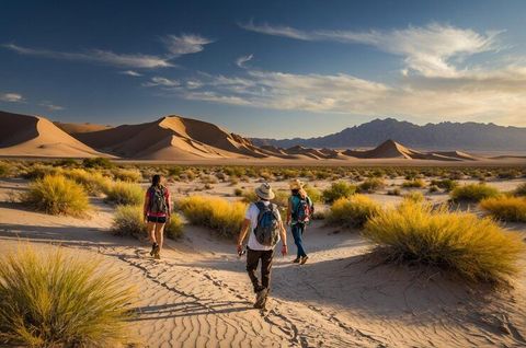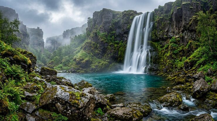
Waterfall circle routes are walking or hiking paths that form a loop and take visitors to one or more waterfalls before returning to the starting point. These routes combine natural scenery, outdoor recreation, landscape observation, and opportunities to explore forest environments without necessarily retracing the entire outward journey.
These routes are found in many regions, including national parks, mountain ranges, tropical forests, and rural landscapes. Some are short recreational walks, while others involve steep climbs, remote terrain, river crossings, or several hours of hiking.
The term can describe a formal circular trail designed by park authorities or an itinerary created by connecting existing paths. The route's difficulty depends on elevation changes, distance, weather, trail conditions, and the number of waterfalls included.
Understanding Waterfall Loop Trails
A waterfall loop differs from a simple out-and-back trail. An out-and-back route follows the same path in both directions, while a loop uses connected paths to return to the starting point by another route.
A waterfall circle route may include:
A primary waterfall and nearby viewpoints
Several smaller waterfalls along a river
Forest trails connecting separate cascades
Mountain paths with elevated viewpoints
Boardwalks and designated observation areas
Picnic areas or visitor facilities
Natural swimming areas where swimming is explicitly permitted
Not every waterfall destination has a complete circular trail. Some locations require visitors to return along the original path, and certain connections may close during severe weather or maintenance.
How Waterfall Circle Routes Are Designed
Trail planners consider topography, water flow, slope stability, ecological sensitivity, visitor access, and emergency response requirements.
A well-designed loop usually has clearly identified entry points, directional information, distance markers, and suitable connections between trail sections. In protected areas, the route may also direct visitors away from fragile vegetation, unstable riverbanks, and sensitive wildlife habitats.
Before choosing a route, hikers should check its total distance, elevation gain, expected duration, surface conditions, and whether the loop is currently open.
Importance of Waterfall Circle Routes
Waterfall circle routes combine outdoor recreation with nature education and responsible landscape exploration. They can help visitors experience several natural features within one planned journey while reducing the need to repeat the same trail section.
Environmental and Recreational Benefits
Waterfall trails provide opportunities to observe forest ecosystems, river systems, geological formations, and changes in vegetation with elevation.
They can also encourage physical activity and provide a structured way to explore natural landscapes. However, the benefits depend on appropriate trail design, visitor behavior, and environmental management.
Waterfall environments are particularly sensitive to erosion and trampling because flowing water, saturated soil, and steep slopes can make surrounding terrain unstable.
Planning for Different Hiking Abilities
A suitable route should match the hiker's experience and physical ability. Short, maintained paths may be appropriate for beginners, while longer mountain loops can require navigation skills, endurance, and preparation for changing weather.
Before selecting a route, consider:
Total distance and elevation gain
Expected walking duration
Trail surface and steepness
Number of river crossings
Availability of rest areas
Emergency access
Weather and seasonal water flow
A route described as circular is not necessarily easy. A short loop with steep rock sections may require greater care than a longer trail with gradual slopes.
Recent Developments in Waterfall Trail Management
During 2025 and 2026, several protected areas announced trail rehabilitation, viewing-platform improvements, and temporary access restrictions. These examples illustrate why current trail information matters when planning waterfall hikes.
Trail Rehabilitation in the United States
In January 2025, the National Park Service began a major rehabilitation project on Laurel Falls Trail in Great Smoky Mountains National Park. The project included improvements to trail surfaces, viewing platforms, parking arrangements, and visitor information. The reopening timeline was subsequently extended, with an anticipated reopening in 2027.
Mackenzie Falls Improvements in Australia
In Victoria, Australia, major construction work at Mackenzie Falls in Grampians (Gariwerd) National Park began in February 2026. Planned improvements include a viewing platform, parking-area upgrades, walking-track work, and measures to improve rock stability.
The announced project schedule anticipates completion by the end of 2026, with closures affecting several walking tracks during construction.
These examples show that waterfall destinations may close temporarily for safety improvements, environmental protection, or infrastructure work. Hikers should confirm access arrangements shortly before travelling.
Laws, Policies, and Environmental Protection
Waterfall circle routes may cross public parks, protected forests, private land, conservation areas, or national parks. Applicable rules therefore depend on the country and the authority managing the land.
Protected-Area Regulations
Park authorities can establish rules covering trail access, opening hours, camping, swimming, wildlife protection, fires, and waste disposal.
For example, national parks in the United States operate under federal regulations and site-specific management rules. Some waterfall areas prohibit climbing, jumping, or entering pools because of injury risks and damage to natural resources.
Trail Safety Requirements
Visitors should follow posted warnings and temporary closures. Barriers may identify unstable cliffs, dangerous currents, falling-rock risks, or damaged bridges.
During heavy rainfall, water levels can rise rapidly, and apparently shallow crossings may become unsafe. Entering restricted areas can put hikers and rescue personnel at risk.
Conservation Responsibilities
Responsible hiking practices include:
Staying on designated trails
Carrying out litter
Avoiding damage to plants and rocks
Keeping a safe distance from wildlife
Respecting protected habitats
Following fire restrictions
Using designated facilities
Avoiding unauthorized camping
These measures help protect natural features while allowing public access to suitable areas.
Tools and Resources for Planning
Digital maps and official park information can help hikers plan an appropriate waterfall route.
Mapping and Navigation
Mapping applications can help identify trail junctions, loop connections, distance, elevation changes, and access points. Downloadable maps are especially useful in areas with limited mobile reception.
GPS navigation can support route finding, but it should not replace preparation or official trail information.
Weather and Water Conditions
Weather applications and park alerts can provide information about rainfall, temperature, storms, and potential flooding.
Before leaving, check:
Current weather forecasts
Recent rainfall
Flash-flood warnings
Trail closure notices
River-crossing conditions
Daylight hours
Fire danger ratings
Equipment Checklist
| Item | Purpose |
|---|---|
| Hiking footwear | Grip and stability |
| Drinking water | Hydration |
| Navigation map | Route finding |
| First-aid kit | Minor injuries |
| Weather-appropriate clothing | Changing conditions |
| Charged phone or GPS device | Navigation and emergency communication |
| Food and snacks | Energy during longer hikes |
| Headlamp | Reduced visibility or unexpected delays |
The required equipment depends on route length, terrain, weather, and remoteness.
Frequently Asked Questions
What is a waterfall circle route?
It is a circular hiking route that connects one or more waterfalls and returns to its starting point through a different section of trail. Some routes are formally marked, while others combine existing paths.
Are waterfall loop hikes suitable for beginners?
Some are suitable for beginners, particularly short routes with maintained paths and limited elevation gain. Others include steep slopes, slippery rocks, and difficult crossings. Check the route's difficulty before setting out.
When is the best time to explore waterfall routes?
The ideal season varies by location. Spring may bring stronger water flow, while summer can provide longer daylight hours. Rainy periods can increase water levels and make trails hazardous, so local conditions should guide the decision.
Can visitors swim near waterfalls?
Swimming is permitted at some designated locations but prohibited or unsafe at others. Strong currents, submerged rocks, cold water, and sudden changes in flow can create serious risks. Follow local signs and park regulations.
How can hikers check whether a waterfall trail is open?
Consult the official website or current alerts published by the park authority or land manager. Check for construction, weather-related closures, damaged bridges, and restrictions before beginning the route.
Conclusion
Waterfall circle routes offer a way to explore cascades, forests, rivers, and scenic landscapes within a connected hiking journey. Their appeal comes from combining outdoor recreation with opportunities to observe geological features, ecosystems, and natural water systems.
Successful planning requires more than choosing a route on a map. Hikers should evaluate distance, elevation, trail difficulty, weather, water conditions, and current access restrictions.
Recent trail improvements in the United States and Australia demonstrate the importance of maintenance, visitor safety, and environmental protection. By using reliable navigation tools, following local regulations, and respecting fragile natural areas, visitors can explore waterfall routes more responsibly and confidently.