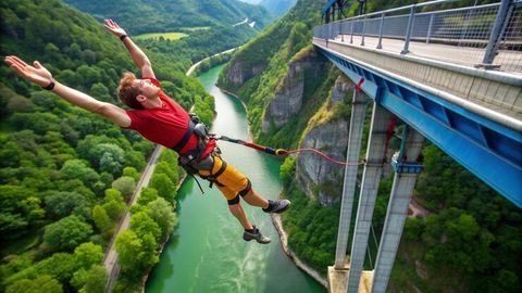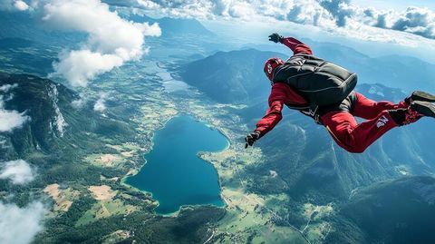
Paragliding over valleys is a form of recreational aviation in which a pilot launches from an elevated location and flies using a lightweight fabric wing. The wing is connected to a harness, and the pilot uses weight shifting and control lines to manage direction and speed.
Valley landscapes are particularly suitable for paragliding because differences in terrain and atmospheric heating can create rising air. Pilots can use appropriate thermal and ridge lift conditions to remain airborne for extended periods while following established flight procedures.
Paragliding destinations can be found across mountain regions, coastal cliffs, plateaus, and valleys around the world. Popular areas include the Alps, Himalayas, Pyrenees, Andes, South African mountain regions, and parts of Australia and New Zealand.
The activity combines outdoor recreation with aviation principles, meteorology, navigation, equipment management, and airspace awareness. Understanding these elements is important for anyone researching adventure travel, paragliding holidays, aviation safety, or travel insurance for adventure activities.
Understanding Paragliding Over Valleys
How Valley Paragliding Works
A paraglider is designed to convert forward movement through the air into aerodynamic lift. The pilot normally launches from a suitable slope and maintains flight by controlling the wing with brake lines and body position.
The basic equipment includes:
Paraglider wing
Harness
Helmet
Reserve parachute
Control lines
Carabiners
Variometer
GPS or navigation equipment
Appropriate clothing and footwear
Unlike powered aircraft, paragliders generally do not have an engine. Pilots rely on gravity, atmospheric movement, and aerodynamic lift to remain airborne.
Understanding Lift
Several forms of rising air can influence a flight.
Thermal lift develops when sunlight warms the ground and creates rising columns of warmer air.
Ridge lift occurs when wind encounters a mountain or ridge and is redirected upward.
Mountain-wave conditions can also produce significant vertical air movement, although these conditions can require advanced knowledge and careful risk assessment.
The availability and strength of these conditions vary throughout the day and across different geographic regions.
Why Valleys Create Distinctive Flying Conditions
Valleys can produce complex wind patterns because surrounding mountains influence airflow. Temperature differences between slopes, valley floors, and higher elevations can create changing wind directions.
For this reason, a pilot must understand local meteorology rather than relying solely on a general weather forecast.
Why Valley Paragliding Matters Today
Growth of Adventure Tourism
Paragliding has become an important component of adventure tourism in many mountain destinations. It provides travelers with an aerial perspective of landscapes that can be difficult to experience from ground level.
The activity is relevant to travelers researching:
Mountain adventure travel
Outdoor recreation
Scenic aviation
Adventure tourism destinations
Paragliding travel
Mountain sports
Travel insurance for adventure activities
The combination of tourism and recreational aviation also means that safety standards and local regulations are important parts of destination planning.
Who Is Affected?
Paragliding regulations and safety practices affect several groups:
Student pilots
Recreational pilots
Tandem pilots
Instructors
Aviation authorities
Mountain tourism organizations
Local communities
Landowners
Search-and-rescue organizations
Clear rules can help reduce conflicts between recreational aviation, commercial aviation, environmental areas, and other outdoor activities.
Importance of Weather Awareness
Weather is one of the most significant factors in paragliding. Wind strength, wind direction, cloud development, visibility, precipitation, and thermal activity can change during a single flight.
A useful preflight assessment can include:
Forecast wind conditions.
Local observations.
Cloud development.
Temperature and thermal expectations.
Launch and landing conditions.
Airspace restrictions.
Emergency landing options.
No forecast can eliminate uncertainty. Local pilot knowledge and current observations remain important.
Recent Developments and Trends
Digital Weather and Flight Planning
During 2025 and 2026, digital tools continued to play a significant role in recreational aviation and outdoor flight planning. Modern pilots can combine weather forecasts, GPS navigation, airspace information, terrain mapping, and flight-recording applications.
These tools can provide useful information before and during a flight, but they should supplement rather than replace pilot training and judgment.
Increasing Focus on Airspace Awareness
As recreational aviation grows, understanding controlled and restricted airspace has become increasingly important. Paragliders may operate near airports, heliports, military areas, protected zones, and other aviation activities.
Digital airspace maps make it easier for pilots to identify potential restrictions before launching.
Equipment Development
Paragliding equipment has also continued to evolve. Modern wings can use advanced materials and aerodynamic designs that aim to improve handling, performance, and durability.
Safety equipment has developed alongside wing technology. Reserve parachutes, modern harness systems, helmets, and electronic instruments are now common components of structured flight preparation.
| Planning Factor | Effect on Valley Paragliding |
|---|---|
| Wind speed | Influences launch and landing conditions |
| Wind direction | Determines usable ridge lift and flight direction |
| Thermals | Can provide additional altitude |
| Cloud development | May indicate changing atmospheric conditions |
| Visibility | Influences navigation and terrain awareness |
| Airspace | Determines where flight can take place |
| Terrain | Affects launch, landing and emergency options |
| Temperature | Influences thermal development |
Laws, Regulations and Aviation Policies
United States
In the United States, paragliding falls within the broader framework of Federal Aviation Administration regulations concerning ultralight vehicles and aircraft operations, depending on the specific aircraft and operating circumstances.
Federal regulations include provisions under 14 CFR Part 103, which covers ultralight vehicles. Operators must comply with applicable operating limitations, including rules concerning congested areas, airports, airspace, visibility, and flight restrictions.
The exact regulatory classification can depend on the aircraft configuration and how it is operated. Pilots should therefore consult current FAA material rather than assuming that every type of paragliding activity falls under the same category.
The FAA also publishes aeronautical charts, notices, airspace information, and safety resources that can help pilots understand the aviation environment.
Europe
European paragliding regulation involves national aviation authorities as well as European aviation frameworks. Requirements can differ between countries, particularly concerning pilot qualifications, equipment certification, tandem operations, instructor requirements, and recognized training systems.
Organizations such as the European Union Aviation Safety Agency provide broader aviation safety frameworks, while national authorities and recognized sporting organizations may establish more specific requirements.
Pilots visiting European destinations should check the rules applicable to the particular country and flying site.
Other Countries
Paragliding is regulated differently around the world. Countries may establish requirements for:
Pilot qualifications
Tandem operations
Instructor certification
Equipment standards
Launch locations
Landing zones
Airspace
Protected areas
Local permits
Environmental restrictions
Mountain destinations can also impose additional restrictions because of wildlife protection, national parks, military zones, or sensitive ecosystems.
Tools and Resources for Paragliding Planning
Weather Resources
Weather information is essential for evaluating potential flying conditions. Pilots can use:
National meteorological agencies
Aviation weather resources
Wind forecasts
Satellite imagery
Radar information
Local weather stations
Mountain weather forecasts
Forecast information should be interpreted alongside actual conditions at the launch and landing areas.
Navigation and Airspace Tools
GPS-based navigation applications can help pilots understand terrain, flight paths, and airspace boundaries.
Useful information sources include:
Official aviation charts
National aviation authority websites
Local flying-site maps
NOTAM information
GPS navigation applications
Digital terrain maps
Flight-recording platforms
Training and Safety Resources
A structured training program is one of the most important resources for people learning paragliding. Training generally covers ground handling, launch procedures, turning, landing techniques, meteorology, equipment inspection, emergency procedures, and airspace awareness.
Travelers considering international paragliding should also review their adventure travel insurance documentation. Policies can classify paragliding differently depending on whether the activity is recreational, tandem, competitive, or instructional.
Preflight Checklist
A basic checklist can include:
Review the weather.
Check wind direction and strength.
Confirm airspace conditions.
Inspect the wing and lines.
Check harness and reserve equipment.
Confirm launch and landing areas.
Carry required communication equipment.
Review emergency procedures.
Inform an appropriate person about the planned flight.
Follow local aviation and site rules.
Frequently Asked Questions
Is paragliding over valleys safe?
Paragliding involves inherent aviation and outdoor risks. Safety depends on pilot training, weather assessment, equipment condition, site knowledge, airspace awareness, and appropriate decision-making. Conditions can change quickly in mountainous environments.
What weather is suitable for paragliding?
Suitable conditions depend on the pilot's experience, location, wing, and local rules. Excessive wind, strong turbulence, thunderstorms, heavy precipitation, poor visibility, or rapidly changing conditions can make flying inappropriate.
How high can a paraglider fly?
Altitude varies according to weather, terrain, local airspace, equipment, and regulations. Pilots must remain within applicable airspace limitations and maintain awareness of aircraft operating in the surrounding area.
Do I need training to paraglide?
Yes. Formal training is strongly recommended and may be required by local regulations or recognized aviation and sporting organizations. Training normally covers equipment handling, launching, flying, landing, meteorology, and emergency procedures.
Does travel insurance cover paragliding?
Coverage depends on the individual insurance policy. Some policies classify paragliding as an adventure activity and may apply specific conditions or exclusions. Travelers should review the policy wording and activity definitions before participating.
Conclusion
Paragliding over valleys combines aviation, mountain environments, weather science, navigation, and adventure tourism. The experience depends heavily on atmospheric conditions, terrain, pilot ability, equipment, and local aviation requirements.
Recent developments in digital weather forecasting, GPS navigation, airspace mapping, and safety equipment have made information more accessible to pilots. However, technology does not replace appropriate training, local knowledge, or sound flight decisions.
Anyone researching a paragliding destination should begin with the local aviation authority and recognized training organizations. Understanding the area's weather patterns, airspace, launch and landing requirements, equipment standards, and insurance conditions can help create a more informed approach to mountain flight.
For international travelers, preparation is particularly important because regulations differ between countries. A responsible approach combines current weather information, qualified instruction, suitable equipment, airspace awareness, and respect for local environmental rules.